Google has begun implementing generative AI in Maps and other geoservices

Google is updating its mapping platforms to integrate generative AI capabilities based on the Gemini model. Innovations will affect Google Maps, Google Earth and Waze, which, according to the company, will help solve complex geospatial problems and improve user interaction with the physical environment.

Image source: techspot.com
New features have already begun to appear for Google Maps users in the United States on Android and iOS devices, TechSpot reports. These include more detailed and contextual search results based on the Gemini model. You can now request information about a place to hang out in the evening in a specific city. The AI will analyze data from Google’s extensive geodatabase, take into account user feedback, and make recommendations.
According to Google VP and General Manager of Geotechnology Chris Phillips, the Gemini model checks and validates information from the Google Maps database, and also links to third-party sources such as blogs, if necessary. Other new features include improved route research, with recommendations for points of interest along the route, and parking information. In addition, Google Maps has added augmented reality functionality and information about possible weather-related delays along the route.
Google Earth will also receive AI support, which will make the work of city services easier. Thanks to new features, they will be able to analyze data faster. For example, a transportation planner could learn which areas have the fewest EV charging stations using multi-task reasoning and AI-generated visualizations. These features were reportedly developed in partnership with Google Research and X, the moonshot factory (Google’s research center), and will begin testing next month.
Waze, which is now fully integrated into Google’s geospatial division, has also received updates using its Gemini AI model. A voice assistant function has appeared that informs the user about unfavorable road conditions. In addition, Waze has made it easier to add school zones to the map, and drivers will now receive warnings when passing them. The feature will be available on iOS and Android later this year.
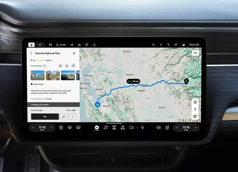
For developers using the Google Maps Platform, Google introduced the “grounding with Google Maps” tool. It allows you to integrate geodata into applications that use artificial intelligence. It is noted that in the near future the American manufacturer of electric vehicles, Rivian, will also begin to implement Gemini capabilities, which will show an AI summary of restaurants and shops on the screens of their cars.

Recent Posts
Study: Apple C1 mobile modem falls short of Qualcomm modems in terms of connection quality in difficult conditions
A study by Cellular Insights Inc. found that Qualcomm's mobile modems perform better than Apple's…
Tesla Warns Trump Administration of Chip Tariffs
Tesla has called on the Trump administration to exercise caution in imposing tariffs on imported…
To better compete with OpenAI, Meta will split its AI team into two
Meta✴ will split its AI teams to better compete with OpenAI and Google, as well…
The Order: 1886 Director Co-Founds New Studio — Atlantis Studio Aims to Conquer the Industry with Innovative Games
Ru Weerasuriya, co-founder of Ready at Dawn, which closed last summer, and creative director of…
Review of the wireless speaker “Yandex Station Street”: Alice in the cities
To be honest, when I first saw the news about the release of the portable…
Blacktail developers announce Davy x Jones — a shooter about the headless pirate Davy Jones in the afterlife of sailors
Polish studio Parasight, known for the folklore action game Blacktail about the young Baba Yaga,…